REVIEWS+

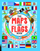
The Maps and Flags Book: ­Explore Amazing Facts, Maps, and Flags of the World

Buster Bks. Sept. 2025. 96p. Tr $22.99. ISBN 9781837250967. Gr 4-6
COPY ISBN
Gr 4-6–Explanations and illustrations of maps and flags are explored in this colorful and informative volume. Through prose and pictures, readers learn about diverse types of maps, including political, physical, and thematic. An explanation of the components of flags is provided, and the chapters on the flags are organized by continents. However, the real draw of the book is an illustration of every national flag along with facts about respective symbols. The flag of Nepal is the only flag with more than four sides, Switzerland’s flag is square, many African countries’ flags contain Pan-African colors, and more. Animal narrators contribute, as when a parrot explains the chosen colors of Brazil’s flag. Data is presented in a digestible way, and students will find this a useful reference for reports, which often require flag drawings. Those curious about cartography and vexillology will enjoy browsing through this volume. ­
VERDICT Easy to absorb information presented in readable prose and bright drawings make this volume a welcome addition to collections. Selectors should consider.

Be the first reader to comment.

Comment Policy:
  • Be respectful, and do not attack the author, people mentioned in the article, or other commenters. Take on the idea, not the messenger.
  • Don't use obscene, profane, or vulgar language.
  • Stay on point. Comments that stray from the topic at hand may be deleted.
  • Comments may be republished in print, online, or other forms of media.
  • If you see something objectionable, please let us know. Once a comment has been flagged, a staff member will investigate.


RELATED 

ALREADY A SUBSCRIBER?

We are currently offering this content for free. Sign up now to activate your personal profile, where you can save articles for future viewing
ALREADY A SUBSCRIBER?