


2018 School Spending Survey Report
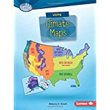
Using Climate Maps
9781512409505.
ea vol: 40p. (Searchlight Books: What Do You Know about Maps?). ebook available. further reading. glossary. index. maps. photos. websites. Lerner. Sept. 2016. lib. ed. $30.65.
COPY ISBN
Informative, accessible, and visually appealing primers on six types of maps. Each volume covers the map type's differentiating features and historical development, information, purpose, and usage; and a final section tests young readers' "map smarts." Color photos and map reproductions complement the texts, which make some challenging cartography concepts clear for young middle graders. "Fun Facts" appended. Reading list, websites. Glos., ind. Review covers the following Searchlight Books: What Do You Know About Maps? titles: Using Climate Maps, Using Physical Maps, Using Political Maps, Using Economic and Resource Maps, Using Road Maps and GPS, and Using Topographic Maps.
ALREADY A SUBSCRIBER? LOG IN
We are currently offering this content for free. Sign up now to activate your personal profile, where you can save articles for future viewing
ALREADY A SUBSCRIBER? LOG IN
Thank you for visiting.
We’ve noticed you are using a private browser. To continue, please log in or create an account.

Be the first reader to comment.
Comment Policy:
Comment should not be empty !!!